Strong Tremors Trigger Landslides in Mountainous Regions
A powerful 5.8-magnitude earthquake struck northern Pakistan on Monday, January 19, 2026, sending tremors through Gilgit-Baltistan, Khyber Pakhtunkhwa, and parts of Punjab, causing panic among residents who rushed out of buildings for safety. The Pakistan Meteorological Department reported that the earthquake jolted multiple districts at 11:21 AM, triggering landslides in mountainous areas and raising concerns about infrastructure damage.
According to the National Seismic Monitoring Centre, the earthquake struck at a depth of 10 kilometers, with its epicenter located in Northwestern Kashmir near coordinates 36.80°N latitude and 74.42°E longitude. The United States Geological Survey recorded a slightly higher magnitude of 5.9 on the Richter Scale, placing the epicenter approximately 50 kilometers north-northwest of Barishal at a depth of 35 kilometers.
Widespread Impact Across Northern Pakistan
Strong tremors were felt across numerous districts in Gilgit-Baltistan, including Gilgit, Skardu, Hunza, Nagar, and Ghizer. In Khyber Pakhtunkhwa, residents of Peshawar, Swat, Shangla, Buner, and surrounding areas reported intense shaking lasting several seconds. The earthquake was also felt in Islamabad, Rawalpindi, and parts of northern Punjab, where residents described noticeable ground movement.
Social media platforms quickly filled with accounts from frightened residents describing their experiences. In the mountainous Hunza and Nagar valleys, people reported particularly intense shaking that prompted immediate evacuation from buildings. Many residents remained outdoors for extended periods, fearing aftershocks that could trigger additional structural damage or landslides.
Landslides and Infrastructure Concerns
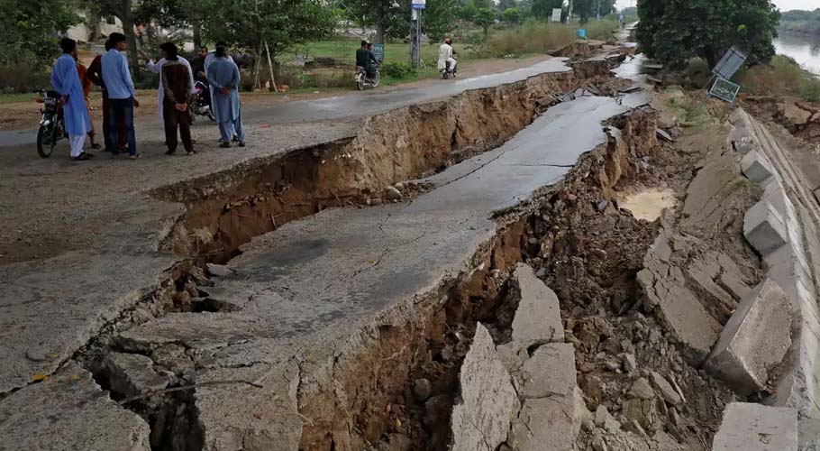
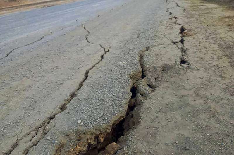
The earthquake triggered immediate concerns in Gilgit-Baltistan’s steep terrain, which is highly vulnerable to slope failures following seismic activity. Footage circulating on social media showed dust clouds rising from hillsides as rocks and earth tumbled down slopes, indicating immediate instability in the aftermath of the tremor.
“In areas like Hunza and Nagar valleys, debris loosened and tumbled down slopes near roadside stretches, raising fears of blocked highways and isolated communities. Local authorities reported rockfalls along the Karakoram Highway, though the extent of damage to critical infrastructure remained under assessment as rescue teams mobilized to affected areas.”
Gilgit-Baltistan lies along the active boundary of the Indian and Eurasian tectonic plates, making the region particularly prone to earthquakes and related hazards. Even moderate quakes in such terrain can produce dangerous secondary impacts like landslides that disrupt traffic, damage infrastructure, and cut off remote communities from essential services.
No Casualties Reported, Authorities on High Alert
Despite the earthquake’s significant magnitude, there were no immediate reports of casualties or major structural damage. However, authorities have urged residents in landslide-prone areas to remain vigilant, as weakened slopes can continue to shed rocks and debris during aftershocks or with minor vibrations.
The Provincial Disaster Management Authority in both Gilgit-Baltistan and Khyber Pakhtunkhwa activated emergency protocols, deploying assessment teams to remote areas to evaluate potential damage and provide assistance where needed. District administration offices established emergency helplines to receive reports of damage or injuries from affected communities.
Pakistan’s Seismic Vulnerability
Pakistan straddles the boundary where the Indian and Eurasian tectonic plates meet, making the country highly susceptible to earthquakes. The collision of these massive geological formations creates intense seismic pressure that periodically releases through earthquakes ranging from minor tremors to devastating major quakes.
This earthquake comes weeks after 5.2-magnitude tremors struck parts of Karachi on December 16, 2025, causing panic among citizens. That quake’s epicenter was in Balochistan’s Sonmiani, approximately 87 kilometers from Karachi, demonstrating that seismic activity affects both northern mountainous regions and southern coastal areas.
Historical data shows Gilgit-Baltistan experiences high seismic activity, with approximately 66 earthquakes per year on average. The region has had at least six quakes above magnitude 7 since 1900, suggesting that larger earthquakes of this size occur approximately every 20 to 25 years.
Challenging Relief Geography
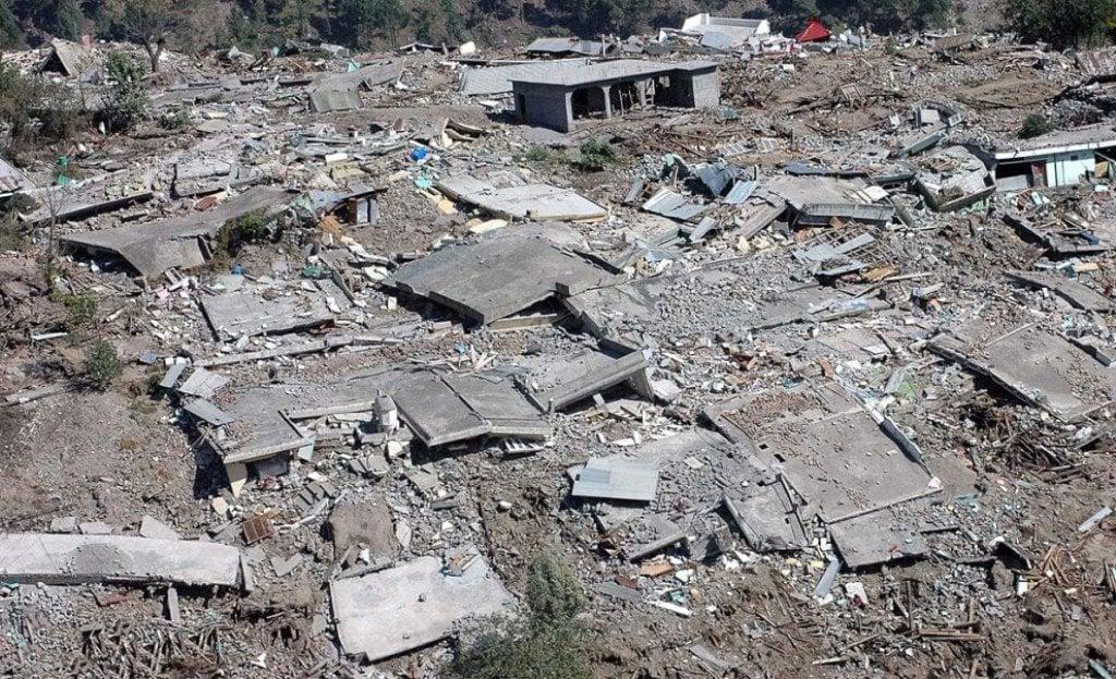
The region can be particularly challenging to navigate during crisis situations due to rugged terrain, limited road access, and harsh weather conditions. In 2015, a devastating 7.5-magnitude earthquake in Pakistan and Afghanistan killed almost 400 people across remote areas where difficult terrain significantly impeded relief efforts.
The 2005 Kashmir earthquake, measuring 7.6 on the Richter scale, remains one of South Asia’s deadliest natural disasters, killing over 86,000 people in Pakistan and administered Kashmir. That tragedy highlighted the vulnerability of mountainous regions where traditional construction methods and difficult access complicate both prevention and response efforts.